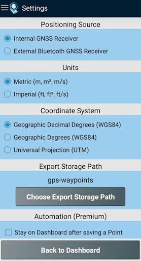
The GPS Waypoints app is an indispensable tool for both personal and professional use. Its user-friendly design and comprehensive features make it ideal for a wide range of applications, from agriculture and forestry to infrastructure maintenance. Users can easily gather data, plot routes, and categorize points of interest using tags and photos. The app's ability to measure distances, calculate areas, and export data in various formats (KML, GPX, CSV) enhances its utility for any project. Whether using the built-in GPS or connecting an external GNSS receiver for improved accuracy, GPS Waypoints delivers reliable performance. Premium subscriptions unlock even more advanced professional capabilities, making it a truly transformative tool in the field.
Key Features of GPS Waypoints:
⭐️ A versatile mapping and surveying application for professional and personal needs.
⭐️ Highly beneficial for various professional land-based surveying tasks, including agriculture, forestry, infrastructure management, urban planning, real estate, and emergency response mapping.
⭐️ Perfect for personal outdoor activities such as hiking, running, walking, traveling, and geocaching.
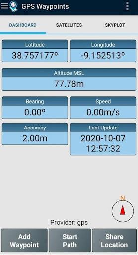
⭐️ Enables the collection of Points (points of interest) and Paths (sequences of points) for mapping and surveying.
⭐️ Users can classify Points with custom tags and photos, and create Paths as temporal sequences of points or using existing Points to define a route.
⭐️ Points and Paths are exportable to KML, GPX, or CSV files for external geospatial processing.
Summary:
GPS Waypoints stands out with its intuitive interface, extensive functionality, and commitment to compatibility and user feedback. It's the perfect solution for anyone requiring precise, efficient data collection and analysis.
Tags : Tools